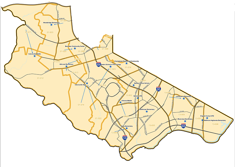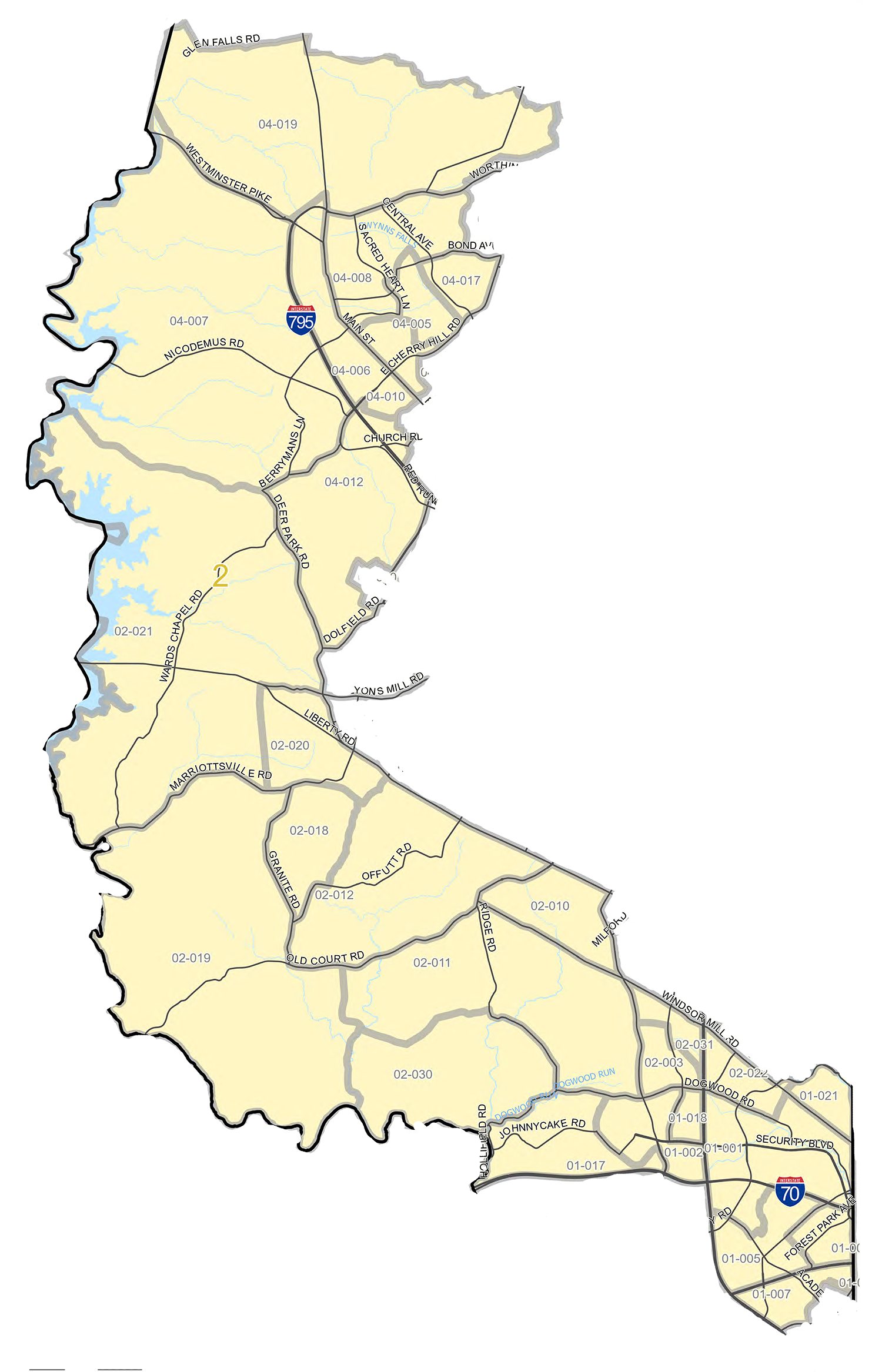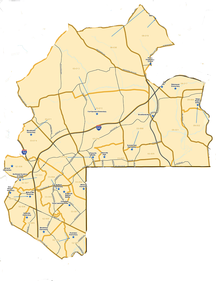
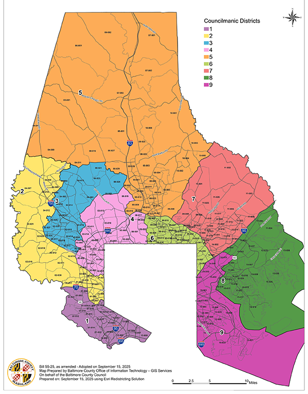
The 2026 Gubernatorial Primary Election will be the first time Baltimore County voters will cast ballots for representatives in nine councilmanic districts.
The reconfigured and renumbered districts take effect after the Nov. 3 General Election. The final map created two majority-Black areas, Districts 2 and 3; and the percentage of white and minorities is about evenly split in District 4. No majority-minority districts were established on the east side in Districts 5-9.
Voters are urged to take note since their councilmanic district may change.
One change, for example, involves Windsor Mill, which currently sits in District 1 but has been redrawn into District 2 with parts of Woodlawn and Reisterstown. Owings Mills and Randallstown are in the new District 3, but the current District 3 covers the north county.
Four years ago, an initiative to increase the council was gaining momentum. The 4More Baltimore County was spearheaded by Linda Dorsey-Walker, a community leader who is running in the new District 3.
The effort to add four seats was not successful but the idea of more representation was. In November 2024 voters approved a ballot question to expand the council from seven to nine members. The referendum raised hopes that more Black, Latino and Asian candidates would be motivated to run for office. They were. This year’s field is more diverse, and dozens across the county will be on the ballot.
The referendum also established a redistricting commission to make recommendations on the boundaries and sparked a debate over race, political power and what constitutes fair representation.
Both the council and the commission, chaired by Eric Rockel, held multiple public-input sessions. In their deliberations, the commission sought to balance federal voting-rights pro-tections while respecting communities of interest and observing traditional redistricting principles.
Some council hearings went on for four hours, giving dozens a say. There have been charges of back-room dealings to secure Republican votes, efforts to carve the districts in a way to protect power and to give a potential candidate an advantage or disadvantage candidate.
For many advocates, the expansion was about strategically creating a council map that more accurately reflects a county that has undergone significant demographical change over the past decades. They insisted that representation is best achieved by drawing districts where Black and minority voters can reliably elect candidates who look like them.
Some recommendations were specific, like the “Woodlawn Map C” aimed at keeping Woodlawn intact within a single district.
Others argued for a race-neutral approach, commenting that a more effective strategy is to disperse those voters across more districts to broaden political influence.
And at least one speaker voiced concerns that redistricting her Lochearn community in with Woodlawn might cause her home property values to decline, her insurance rates to rise, and crime to increase.
The commission labored for weeks, only to have the council set aside its final report and create its own maps. After considering multiple versions and voting on several amendments, the council introduced still another map to the dismay and frustration of the elected officials and community members who were present and listening to the livestream.
The council has been largely male and mostly white since 1956 when it was established. It took redistricting efforts to increase the odds for women and minority candidates.
The election will determine if the redistricting met at least one of its goals, which is to diversity the council. In the past 70 years, only five women have served on the council. It also took redistricting in 2001 to create a majority-black district to elect the first black councilperson from Baltimore County and the first black state delegates and senators.
The only blacks to serve on the Baltimore County Council have been Ken Oliver and Julian Jones, both of District 4.
Click on the map images below to view more detail from Baltimore County Office of Information Technology’s GIS Department.